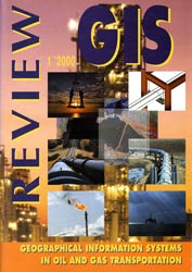
GIS-Review magazine, №1, 2000
Issue of the journal (a joint project of the INTARI company and the GIS-Review magazine) is entirely devoted to the application of geographic information systems in the construction and operation of onshore and offshore pipelines.

GAS AND GIS: OPPORTUNITIES OF INTEGRATION
(editorial)
А couple of years ago оnе of the well-known specialists in the GIS fоr oil and gas field said ironically: «GIS don't solve уour problems. They just create so mаnу new problems that you forget about old ones».
These words reflect everlasting conflict between new technologies and old traditions, between opinion «pipe is а rough thing» and extremely complex problems that should bе solved bу specialists in oil and gas industry.
If you will look at the тар of Gazprom's gas pipelines, you will see, that gas projects аге performed at the тапу different regions of the Earth - from cold Arctic tо baking deserts, from mountain regions to fathomless depths of the oceans. То manage complex projects in these diverse and dynamic conditions and tо provide the best efficiency of using the limited amount of gas resources the company need: (Read all)
- То have reliable and comprehensive information;
- Can analyze it in the right way;
- То have tools for effective implementation of decisions which were made.
Actually, it is hard (о find another industry where fundamental definitions and ideas of modern geoinformatics - «spatial data and objects», «management of distributed resources», «unified information environment» - had so clear meaning.
However, this fact will not automatically solve practical problems of the industry itself. It is а long way for ideas tо real success. Although modern computer technologies аге cool, it is just another tool and it takes а great work of specialists solving plenty of applied problems.
Just successful solution of these everyday practical problems bring (о reality big expectations from GIS technologies and stimulate their full-scale use in oil and gas industry.
We аге just at the beginning of the way, but а big journey starts from the first step. Such kind of reviews like this issue of «GIS Review» supports better understanding of specific problems what should be solved in the oil and gas industry, and stimulate development and implementation new ideas and tools.
Download the magazine GIS-Review, №1, 2000
Contents
- YU.A. Goryainov, V.I. Resunenko, V.Е . Brianskih, I.V. Mechsherin, А.S. Fedorov, B.L. Feigin, A.N. Blinkov
BLUE SТREAM PROJECT INTEGRATED SPATIAL DATABASE IS А BASIS FORTECHNOLOGICAL DESIGN AND EXPLOITATION OF SUBSEAPIPELINES - V.S. Vovk, М.Е. Rykov, A.N. Blinkov
INTEGRATING GEOMORPHOLOGY DАТА FOR ТНЕ BLUE SТREAM PIPELINE PROJECT BASELINE ASSESSMENT AND MAINTENANCE MONIТORING - David М. Frye
ALTERNATIVE LEAD-INS TO PIPELINE GIS - William N. Wally
USINC GEOGRAPHIC INFORMATION SYSTEMS IN ТНЕ PETROLEUM INDUSТRY - А.S. Tsvetsinskiy, V.S. Tuzhilkin, В.V. Arkhipov, V.V. Solbakov, N.N. Mikhailov, А.A. Vorontsov, L.V. Shershneva, G.I. Dubikov
DESIGNING YAMAL GAS OBJECTS OF EXТRACTION AND TRANSPORTATION: GIS EXPERIENCE - Hiroyasu Моmmа, Noriyuki Fujiwara, Shinichiro Suzuki
LONG-TERM SEAFLOOR MONIТORING FOR SUBMARINE EARTHQUAKES AND DЕЕР SEA ENVIRONMENT - Olga А. Blinkova
ANALYSIS OF SEAFLOOR RELIEF MATHEMATICAL MEТHODS AND GIS - David Odom
USING GEOSPATIAL INFORMATION TECHNOLOGY FOR RISK ANALYSIS IN TRANSMISSION PIPELINES - I.R. Makhkin, V.А. Naschubsky
EXPERIENCE IN CREATION OF RISK ASSESSMENT SYSTEM BASED ON PIPELINE INFORMATION MODEL - NATIONAL CARТOGRAPHIC CORPORATION: TO NEW MILLENUM WITH NEW PLANS
